![]()
![]()
// COLLECTIONS // Cartography
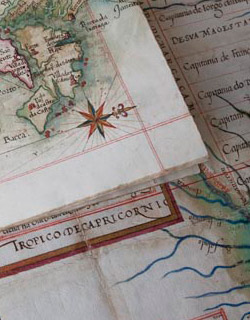
The Ajuda Library’s cartographic documentation is made up of both atlas and sundry maps, views and plans, some of which are manuscript and some printed, and others that are attached or annexed to historical documents. There are around 1,000 titles, the most significant of which include a number of manuscripts, such as Roteiro de todos os Sinaes, which is attributed to Luís Teixeira, and Descripção de toda a costa da Provincia de santa Cruz a que vulgarmente chamão Brasil by João Teixeira, which is dated 1642.
Leading items in the collection of printed atlases include Cláudio Ptolomeu’s Theatri Geogarphie, Georg Braun’s Civitatis Orbis Terrarum, Abraham Ortel’s Theatrum Orbis Terrarrum, and Gerard Mercator’s Atlas. There is also an important set of atlases from the Low Countries – Holland and Belgium – such as the Atlas Mayor by Joan Blaeu, the Nuevo atlas by Jan Jansson, and various atlases by Gueudeville. The Library also has some French atlases, like L’Atlas de la mer by Pieter Goos, Nouvel atlas de la Chine by Jean Baptiste d'Anville, Atlas du voyage de la Pérousse by L. Auber, and Néptune Français by Hubert Jaillot, among others.